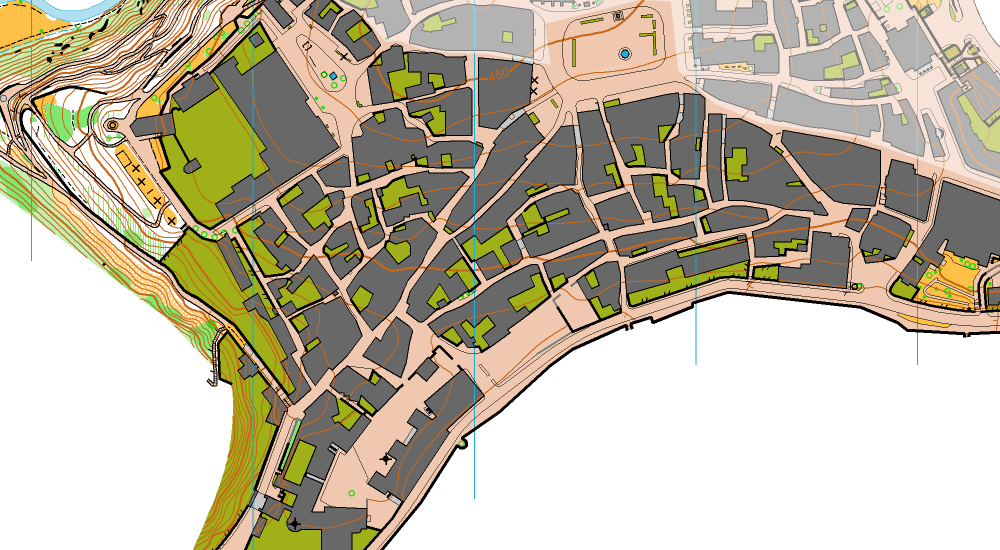
Sample of the map
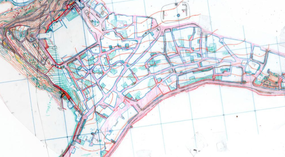
Original drawing by Jan Drbal
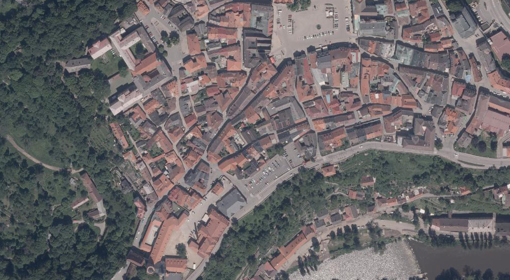
Sample of the basemap, ortophoto
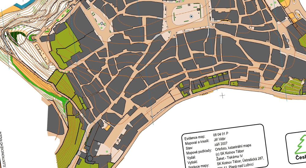
Sample of the basemap, previous o-map
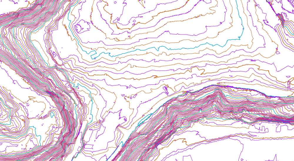
Sample of the basemap, DMR 5G (contours interval 1m)

Tábor | 1:4 000 | e = 2m | Czech Republic | 2012
South Bohemian Region - Tábor Google maps
Tábor sprints, 2 sprint races, 25th March, SK Kotnov Tábor
basemap: ortophoto, previous o-map Tábor (2007 - Jiří Vébr), DMR 5G (laserscan - for contours)
únor 2012: Jan Drbal (50% of the area), Zdeněk Sokolář
April 20th 2012 | Jan Drbal
Tábor (1:4 000) is an ISSOM map showing a labyrinth of narrow streets and a steep park in an old center of the South Bohemian historical town, which is one of the best o-terrains of its kind in my country. The map was used on 25th March for a traditional local sprint event (two rounds), this time with Czech national teams among participants.


Sample of the map
Original drawing by Jan Drbal
Sample of the basemap, ortophoto
Sample of the basemap, previous o-map
Sample of the basemap, DMR 5G (contours interval 1m)