
Sample of the map

Original drawing by Jan Drbal

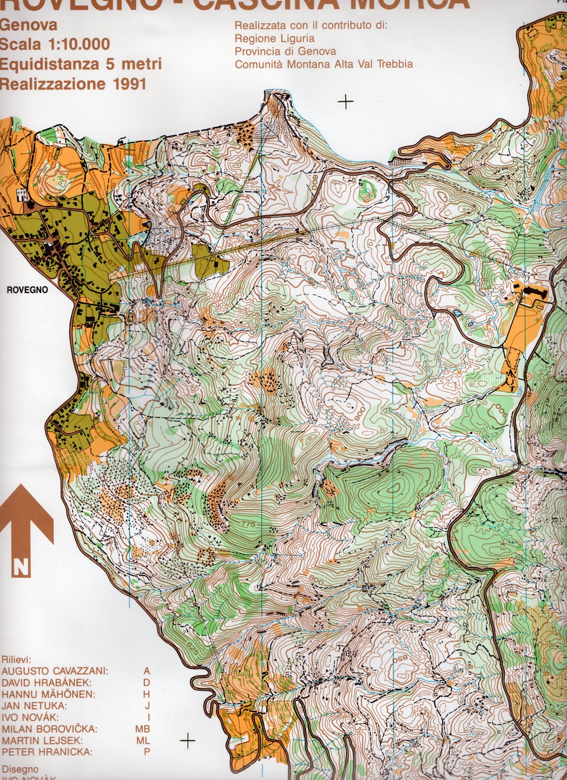
Sample of the basemap, previous o-map Rovegno (1991)

Sample of the basemap, ortophoto

Bosco di Annibale | 1:10 000 | e = 5m | Italy | 2011
region Liguria - Val Trebbia - Rovegno Google maps
Coppa Italia, middle, 22th April 2012, Delegazione Liguria
basemap: previous o-map Rovegno (1991), ortophoto
September 2011: Jan Drbal (15% of the area), Rudi de Ferrari, Martin Lejsek, Giaime Origgi
April 21st 2012 | Jan Drbal
A middle distance race of Italian Cup (Coppa Italia) will be held on the map Bosco di Annibale (=Hannibal's Forest) near Rovegno in Val Trebbia (Trebbia Valley) in northern Italy on Sunday, April 22th. Most of the work was done by Rudi Ferrari and Martin Lejsek. I revised/remapped a piece of Italian Augusto Cavazzani's well-done part of the older o-map Rovegno - Cascina Morca (1991) in last September. Beside Cavazzani, six Czech mapmakers and also the legendary Finn Hannu Mähönen participated in making this large previous map (12km²). Follow the Rudi's blog (in Italian) to learn of an ancient as well as a newer orienteering history of Val Trebbia. Sunday's race is a part of Liguria 2012 - series of competitions and trainings in 5 days. For example there will be a regional championship of Liguria on our last year's map Monte della Cavalla on Saturday.
A 5-days competition in the summer 2013 will be the next major o-event in this area (in the period just before World Masters Games - including orienteering - in Torino, 200 km from there). A month ago, I together with Milan Bílý mapped another area just next to the Bosco di Annibale map near the Pietranera village for the fifth stage of the 5-days. The last remaining and, as Rudi said, the most interesting map should be done in the fall.


Sample of the map
Original drawing by Jan Drbal
Sample of the basemap, previous o-map Rovegno (1991)
Sample of the basemap, ortophoto